


Voting District 0003, Hardeman County, Texas
About
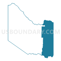
Outline

Summary
| Unique Area Identifier | 673612 |
| Name | Voting District 0003 |
| County | Hardeman County |
| State | Texas |
| Area (square miles) | 166.58 |
| Land Area (square miles) | 166.36 |
| Water Area (square miles) | 0.22 |
| % of Land Area | 99.87 |
| % of Water Area | 0.13 |
| Latitude of the Internal Point | 34.23926390 |
| Longtitude of the Internal Point | -99.54457950 |
Maps


Graphs
Select a template below for downloading or customizing gragh for Voting District 0003, Hardeman County, Texas


Neighbors
Neighoring Voting District (by Name) Neighboring Voting District on the Map
- Voting District 0002, Hardeman County, TX
- Voting District 0007, Wilbarger County, TX
- Voting District 0019, Wilbarger County, TX
- Voting District 0021, Wilbarger County, TX
- Voting District 0201, Foard County, TX
- Voting District 0301, Hardeman County, TX
- Voting District 18, Jackson County, OK
- Voting District 19, Jackson County, OK
Top 10 Neighboring County Subdivision (by Population) Neighboring County Subdivision on the Map
- Quanah CCD, Hardeman County, TX (2,979)
- West Jackson CCD, Jackson County, OK (2,043)
- Crowell CCD, Foard County, TX (1,164)
- Chillicothe CCD, Hardeman County, TX (1,002)
- Lockett CCD, Wilbarger County, TX (800)
- Fargo-Odell CCD, Wilbarger County, TX (586)
- Thalia CCD, Foard County, TX (172)
Top 10 Neighboring Place (by Population) Neighboring Place on the Map
Top 10 Neighboring Unified School District (by Population) Neighboring Unified School District on the Map
- Vernon Independent School District, TX (12,955)
- Quanah Independent School District, TX (3,169)
- Crowell Independent School District, TX (1,372)
- Chillicothe Independent School District, TX (1,185)
- Olustee Public Schools, OK (723)
- Eldorado Public Schools, OK (628)
Top 10 Neighboring State Legislative District Lower Chamber (by Population) Neighboring State Legislative District Lower Chamber on the Map
Top 10 Neighboring State Legislative District Upper Chamber (by Population) Neighboring State Legislative District Upper Chamber on the Map
- State Senate District 30, TX (823,594)
- State Senate District 28, TX (704,340)
- State Senate District 38, OK (70,224)
Top 10 Neighboring 111th Congressional District (by Population) Neighboring 111th Congressional District on the Map
Top 10 Neighboring Census Tract (by Population) Neighboring Census Tract on the Map
- Census Tract 9501, Hardeman County, TX (4,139)
- Census Tract 9683, Jackson County, OK (2,043)
- Census Tract 9503, Wilbarger County, TX (1,849)
- Census Tract 9501, Foard County, TX (1,336)
Top 10 Neighboring 5-Digit ZIP Code Tabulation Area (by Population) Neighboring 5-Digit ZIP Code Tabulation Area on the Map
- 76384, TX (12,991)
- 79252, TX (3,202)
- 79227, TX (1,406)
- 79225, TX (976)
- 73560, OK (829)
- 73537, OK (643)